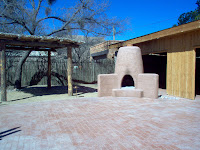
We have a new favorite place in southern Arizona, Chiricahua National Monument. South of Wilcox, Arizona. The monument is unlike anything we have yet to see in the southwest. There are stands of juniper and pines, streams, deer and lots of birds.
The CCC laid out the paths in this park. I am a big fan of the CCC and am thankful for the wonderful job they did in American Parks. What a legacy they left to us!
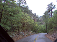
This area was the site of an ancient volcano eruption that was much like the one on Mount Saint Helen's, but much more violent. The rock formations, called tuffs, are the result of the ancient volcanic activity and the action of erosion.
These rock formations, for lack of a better word, are amazing.
This formation, on the left, is called Organ Pipes, for obvious reasons.
Unfortunately, we picked one of the only rainy days in Southern Arizona to drive out to the park. We thought the rain would be over by mid-morning and we would be able to hike into the wilderness.
It was not to be. So we made the best of things and drove up to Massai Point in the rain. The clouds covered the highest peaks, but we were able to get some good pictures of some of the more spectacular formations.
This area was home to the Apache Indians, and most notably, Cochise. Ft Bowie is nearby. Southern Arizona is one of the most desolate, deserted places I have ever visited, but what a wonderful place to be if you yearn for peace and solitude, and nothing but the sound of birds and the breeze in the junipers.
Chiracahua National Monument has a beautiful campground and is close enough to Tucson that it would be easy to take the camper for a weekend. This park sees relatively few visitors throughout the year, and we enjoy the peace and solitude of having the park all to ourselves.
“Our battered suitcases were piled on the sidewalk again; we had longer ways to go. But no matter, the road is life.” - Jack Kerouac
Thursday, May 21, 2009
Saturday, April 4, 2009
Sedona's Vortexes and Red Rocks
Sedona, AZ 4-4-2009
Recently, I said I wanted to settle somewhere that was beautiful. Arizona is beautiful. Especially our current location, Sedona. This is RED ROCK country, and the scenery surrounding this village is magnificent. I have never seen anything like it.
The village is full of artists and quaint shops. The full time residents have built adobe houses in colors that reflect the surrounding cliffs. These are my kindred spirits.
I was reading some blogs by other people who are just like us - full timers, wandering around the country - and one couple mentioned a camp ground they had stayed at in Sedona called Rancho Sedona. I called and made reservations and it turned out to be wonderful.
We are staying in a canyon that runs right along the village, yet there is a steam running past and it is quiet and full of trees.
Today we took two hiking trips. The first was to Fay's Canyon, a 2.5 mile hike into a canyon. The picture above is taken from the bottom of that canyon. Then we ventured out to Chapel Rock Trail.
The local story is that 64% of tourists that come to the area (according to C of C statistics) come for spiritual reasons. What they mean by that is that people come to visit the vortexes where they believe creative energy is centered.
One of our hikes was to Chapel Rock which is where a vortex is supposed to be located. We hiked about 1.2 miles out to the vortex zone.
At the vista there were medicine wheels and other shrines that people had built. I do not know enough about New Age religion to explain the significance. But, to Christians, the area reminded us to worship the creator, not the creation. And, HIS creation is magnificent.
Tonight, though we had hiked about five miles up and down rocks and in and out of canyons, Bill said he felt refreshed. The vortexes are supposed to impart rejuvenation, so maybe they did work some magic on us.
At the end of the day we drove into Oak Canyon to see spectacular bluffs and magnificent vistas as the sun set on the red cliffs. This is one of the most beautiful places I have ever been.
Tomorrow, we are headed north.
Friday, April 3, 2009
Sabino Canyon, Arizona
April 2, 2009
Sabino Canyon lies on the north side of Tucson, at the very edge of the residential area. Since today was Bill's birthday, he was in charge of the itinerary.
We were amazed to find Sabino Canyon full of visitors. It is a very popular place for hiking, mountain biking and birdwatching. We had stopped by Beyond Bread, our favorite lunch spot, and picked up sandwiches to go and packed our backpack with food and water for the hike up into the Canyon. As you can see by this picture, the desert paths were clearly marked, so easy to follow.
The more popular area in Sabino Canyon is Seven Falls, which must be reached by tram, so most of the visitors were headed there. We took the road less traveled.
Even though the temperature was in the moderate 70's and a gentle breeze was blowing, the sun was shining so intensely here that it felt hot. Our final destination was a nice cool oasis, a spring fed river flowing out of the mountains, which was about a mile up the canyon.
Once again I am amazed at finding water in the desert. This picture is of the river bed, taken from the top of the dam where we sat and ate our lunch.
This is a view looking up the canyon. It is hard to imagine that this river runs right next to the desert landscape that is pictured above.
Bill did spot a large bird's nest next to the river. After making some distressed mouse calls, a beautiful, golden colored hawk peer over the side of the nest at him.
Later, we stopped a park ranger who identified the bird as a Cooper's Hawk and said this had been the first sighting of the bird, since the park service had thought they would not come back this year. Apparently, they build their nests on top of another and generally come back until the nest becomes uninhabitable because of mites.
We came home and had ice cream to finish off the celebration. I think Bill had a nice birthday, doing the things he loves to do - spending time in the great outdoors and birdwatching. Happy Birthday, Bill. I love you.
Wednesday, April 1, 2009
Southern Arizona
" It was a long life, and during it she inhabited many different selves." Someone please remember to put this quote on my tombstone one day.
I can think of nothing I love to do more than to travel. To see the interesting way other people live and to contemplate what it must be like to live as they do. One thing I know for sure, I will never live like my neighbors in the campground, who stay shut up in their giant motor coaches day and night, the television blaring, yelling at their yapping dogs and at each other. It is not the life for me.
Today, we drove through the Sonoran Desert, to a place called Arivaca Lake. The desert road wound around the tops of the foothills, and at each dip in the road a yellow sign warned not to enter if flooded.
It is hard to imagine this dry, barren place with enough water to be a danger to vehicles. I am always surprised to find lakes in the midst of the desert.
Lake Arivaca is located off of Ruby Ranch Road, 2 1/2 miles down a gravel path. Lake Arivaca's existence seems incongruous, set in the midst of dry parched sand dunes.
Though it was clear and blue, it was also tainted with Mercury, according to another government warning. You cannot eat the fish caught from the lake. The loons didn't seem to mind, diving and paddling in a pool they had all to themselves, except for a few vermillion flycatchers and swallows.
It seemed as if we would be all alone, so far were we from civilization, but at the top of a hill we spotted a camera focused on the hills that butted up against Mexico. And on top of the camera, a radar. Bill surmised that the radar was to track movement.
We only stayed for a short time, since there were signs all along the road of illegal traffic. Empty water bottles in the arroyos, abandoned camp fires, a handprint on the back of road signs, which is supposed to indicate that a member of the Mexican Mafia had been there.
The hand sign is supposed to mean eternal war, and since we were only armed with Dorito Chips and Fig Newtons, we decided not to engage in battle and turned the car around.
Since we don't start work for another week or so, we are going to take an extended trip to Sedona and the Grand Canyon, leaving on Friday morning. There is a famcamp close to Flagstaff called Camp Tuthill where we will try to get a campsite for a few days.
Tuesday, March 31, 2009
Tortilla Mts and the Tonto Forest
3-30-09
The AFB Base turned off the water to the campground, so we were forced to leave for the day. We decided to drive to an area north of Phoenix and explore the Tortilla Mountains and the Tonto National Forest.
We drove north out of Tucson, towards Phoenix, and turned off on a good road that led through the mountains and past several state parks, lakes and dams on the Salt River.
What we didn't know is that half way through the trip the road becomes a one lane winding, dirt path with a 10% grade. There were a lot of motorcyclists on the mountain road, but they all stopped at Tortilla Flats. We would soon find out why.
At the top of the next mountain, and just past a spectacular overlook, the pavement stopped. We had come so far that we decided to continue down the mountain on the single lane road.
The pay off was that there were few people on this trek of the journey, (though we did see a Fedex Ground delivery truck) and the vistas were spectacular.
We drove down the steep canyons, along the Salt River and the lakes that had been created by the dams. The Apache Lake is 266 feet deep!
For being so close to Phoenix, the area is quiet and relatively deserted. We also made a side trip to the Tonto Memorial Park, which was the site of some Indian cliff dwellings. Unfortunately, we got there so late in the afternoon that we did not have time to climb the hills to get to the site. We will have to save that adventure for another day.
Sunday, March 29, 2009
Missions and Wine Country
Saturday we planned another trip south to see two important missions and then would complete the journey with a visit to Arizona wine country.
Traveling south on I-19, we made a side trip just south of Tucson to see the mission, San Xavier del Bac, one of the oldest Spanish missions in the US. It was founded by Father Kino, who built a mission and a community from the sand and cactus of the desert. Sap from the cactus was actually used as an adhesive in the manufacture of the adobe that covered the structures.
I learned something from Father Kino's mission. The Garden of Gethsemane was not just the site of an olive grove and press. Olives have to be knocked from the tree and then, to get the oil, crushed under a heavy mill stone. Oil from the olives would flow through a groove and into jars. The millstone itself was called a "Gethsemane." The night before Jesus was crucified, the Bible tells us that while praying, he perspired blood.
This metaphor, of the crushing weight of sin, is often overlooked, but would have been immediately recognized by those familiar with the production of olive oil.
The next stop was Tumacacori National Historical Park, another Spanish mission. The gardens at the mission were cool and peaceful, patterned after the quiet places that priests once created here for contemplation.
On this particular day interpretors were scattered throughout the park so we had the benefit of getting some additional information about the early inhabitants. We also got to taste some paper thin tortillas, like the early natives ate. They were delicious!
Because this site is run by the State of Arizona, there was some odd editing of the Christian significance of the buildings and purpose of the rooms. Other that this annoyance, it was an interesting place to visit.
Finally, we made our way around to Arizona wine country, Elgin and Sonorita. We stopped at the first winery, Villages of Elgin, which was about 8 miles off the main highway, and signed up for a wine tasting. For $3/person, you were given a nice, big wine glass and a taste of five different wines.
Lest you think that these wineries are like the ones pictures in Napa Valley, California, I have posted a picture here. (No bathrooms, just port-a-potties).
We visited three wineries and bought several bottles of wine before leaving for home.
On the road to Tucson, we decided to pull over here and eat our picnic lunch.
A quiet place, the air so clean and crisp and the breeze keeping us cool in the hot March sun. All that was missing was a hammock.
Can you tell we really like Arizona?
Thursday, March 26, 2009
Tucson Desert Museum
March 26, 2009
This afternoon we stumbled upon a gem in the desert, The Tucson Desert Museum. We were heading out to the Saguero National Monument and came upon the museum and decided to stop.
The admission price was $13/person. I thought that was a little steep for a museum, but we paid the price anyway and went inside. I was wrong to have questioned the price! The Desert museum was wonderful. We spent three hours walking through desert loops, aviaries, cactus gardens, and exhibits.
Three hours was not long enough to see everything. A combination of botanical gardens, zoo and museum, this is one of the most interesting places we have visited on our trip out west.
There were ramadas (above, right) placed strategically throughout the park so we could sit in the shade and gaze out on the beautiful, Saguero covered mountains. We also learned some interesting facts for our next trivia game. For instance, baby javelina are called "reds."
Wednesday, March 25, 2009
Bisby, Arizona
March 24, 2009
Today we traveled south of Tombstone to the town of Bisby. It is known as an artist's enclave and it is a quaint town with a lot of potential - though much of it is wasted.
The best part of the trip, though, was the beautiful scenery. The picture at above is the tunnel at the end of the journey. Just the other side is the town of Bisby.
We had driven to Ft Huachuca first, and after Bill got a military hair cut, we took the scenic drive to Bisby.
Once there, we stopped in the visitor's center. When I signed the guest book I noticed that more than half the visitors were Canadian citizens.
We ate at a fairly decent Mexican restaurant and then walked up and down some of the streets, but we found that most of them were used clothing and furniture stores and there were few real artisans.
It didn't matter though, because as I said, the highlight of our day was the beautiful mountains.
On the way home we drove through Tombstone and I got a picture of my sister's high school, now closed and boarded up. Then we drove on to Benson where we stopped at the only two cemeteries in town and we got out and walked up and down the rows, looking for my Aunt Kit's grave.
We never did find it. For now, the location is our unsolved mystery.
Thursday, March 19, 2009
Pictures of Our Trip
So far, we have been on the road for five weeks. We are having a wonderful time and will have a lot of good memories from the time of transition.
I thought I would post some more pictures that could not fit in previous posts. The first shot is taken down the main street of Tombstone, Arizona.
This is the accelerator that was used to test the force of gravity on man. The first scientist tested it on himself and withstood 64 Gs. This is at the Space Museum in Alamogordo, New Mexico.
These are some more pictures from the Gila Cliff Dwellings in New Mexico.
Some more pictures of the petroglyphs in New Mexico.
Mt Lemmon, Arizona
March 19, 2009 Tucson, Arizona
This morning the AFB announced that the electricity would be off in the campground. Since it is in the mid-80's today, we decided that we had better find something to do away from the trailer until the electricity was on again.
We decided to make a short trip to Mt. Lemmon. Tucson is desert surrounded by mountains. Just to the north and east of us is a popular ski resort, Mt. Lemmon, which is over 9000 ft in elevation. This, we thought, would make an interesting day trip.
There were few cars on the road to Mt. Lemmon this morning. Mostly, there were lots and lots of cyclists. Fortunately, the winding roads had a bike lane so we did not have to worry too much about making way for bikes.
The first part of the journey was through beautiful desert scenery, complete with large saguaro cactus. There is a picture ( above left) of the large saguaros. At about 4000 ft, the scenery changed from desert cacti and ocotillo to tall pine trees and warnings of black bears and mountain lions.
The temperature when we started out was in the mid 70's. When we got to the top of the mountain the temperature was 56 degrees and there was snow on the north side of the slopes.
As you can see in this picture, there is still a significant amount of snow on the mountain. We got to the top of the mountain where the ski lift is and determined not to take the unpaved road down the side of the mountain, and instead, drove back down the way we came.
It was a pleasant, and cool, way to spend an otherwise hot day. And, I am always amazed at the different climates and vegetation all within just 30 miles of the desert.
The people who live here are enthusiastic about Tucson. There is a lot to do here and a lot to see. I share their enthusiasm for such a lovely oasis in the desert.
Tuesday, March 17, 2009
Tubac and Old Tombstone
Tombstone, Arizona
March 18, 2009
This morning we awoke, ready for a new adventure. So, we got out the map and plotted a day trip south on Hwy 19 to the artist's colony at Tubac, Nogales and Tombstone. These are all a short distance from Tucson.
Tubac was a surprising find. About 45 miles south of Tucson is a small village full of little shops, galleries, and cafes mixed in among the historic mission. We spent the afternoon walking the streets, stopping in interesting shops and pricing the huge clay pots.
At the moment, we have no place to store these finds or I would have bought several for myself. When we finally settle down again, I plan to add more color to my life.
We were surprised at the number of people who live this far south of Tucson, and between Tubac and Nogales. There are, apparently, a lot of jobs in this area, probably because of its proximity to the Mexican border.
We drove south to Nogales. I had read of quaint shops and cafes in this town, but we did not find them. We did see the border fence, however, though I could not get a picture of it as we drove through town.
We took Hwy 82, a scenic route, towards Tombstone. This area is very rugged, with deep canyons and arroyos and jagged mountains. We followed the scenic highway almost all the way to Tombstone.
The first historic site we came to in Tombstone was boot hill where we walked through the cemetery and learned that a large number of Tombstone residents died of shotgun wounds or were hanged.
In the main part of town we found the road blocked off to through traffic. We parked and walked the streets, looking in the shops and stopping at Big Nose Kate's Saloon for lunch.
Kate, as you may know, was Doc Holiday's common law wife. We ate hamburgers and watch the staged fights between gun slingers and listened to western ballads.
On the way home we stopped in Benson and found a cemetery that we hoped might be where my aunt was buried. Unfortunately, we did not find here so need to get some further clues about where she might be before we go back and look again.
Monday, March 16, 2009
Literary Weekend in Tucson
We spent a great weekend attending a literary festival - The Festival of Books - at the University of Arizona. The picture at right is of J.A. Jance, a crime story writer from Arizona who gave an entertaining and informative talk at the end of the festival. She has written over 40 books.
I stayed up late last night to read one of her books, Cruel Intent, so I would have an idea about what she writes and whether or not I liked her writing before I attended her speech.
Though a graduate of the University of Arizona, she spoke about the lack of respect genre fiction gets in university English Departments. She is a great story teller, in person as well as in print.
We also heard children's authors, the writers of westerns and DIY books. The festival included booths with local literary related businesses. There was an attempt to appeal to all ages. There was also some great entertainment, including a mariachi band made up of children.
It was a beautiful weekend and we enjoyed ourselves immensely. These are the kinds of things we like to do with our spare time.
We did buy one book, a western by Johnny Boggs that he autographed for us.
This week we hope to visit Tombstone and Tubac, a village of artisans. I really like Tucson. I can understand my grandparent's attraction to this place.
Subscribe to:
Posts (Atom)